
Historical Storms
Past storms that have shaped Baja California Sur. Some made direct landfall. Others passed nearby but still caused serious flooding, surf, road damage, power outages, and disruption. Understanding storm history helps residents and visitors prepare for what the Eastern Pacific can bring.
Hurricane Norma
A slow-moving October hurricane that brought destructive rain, flooding, wind, and surf to southern BCS.
Cat 4 peak / Cat 1 landfall near El Pozo de Cota, Baja California SurOct 21, 2023
Synopsis
- Peak intensity
- Category 4
- Baja impact
- Oct 20-22, 2023
- Landfall or closest pass
- Category 1 landfall near El Pozo de Cota, west-northwest of Cabo San Lucas
- Primary hazards
- Extreme rain, flash flooding, wind damage, storm surge, dangerous surf, road disruption
Norma rapidly intensified to Category 4 south of Baja California Sur, then weakened while moving slowly toward Los Cabos. It made landfall near El Pozo de Cota on Oct 21, 2023, as a Category 1 hurricane before crossing the southern peninsula and continuing toward Sinaloa.
Local impacts
- Exceptional rainfall affected southern Baja California Sur, including 488 millimeters at El Quemado, 480 millimeters at San Vicente de la Sierra, and 473 millimeters at La Palmilla.
- Flash flooding and runoff damaged roads and disrupted travel across parts of Los Cabos and La Paz municipalities.
- Strong winds downed trees and power lines and damaged buildings near the landfall area.
- Large, destructive waves and coastal flooding affected exposed shores and marine activity.
- Closures and interruptions affected airports, ports, schools, businesses, and other services while the storm crossed the region.
Lessons learned
Norma showed how a storm's speed, rainbands, and terrain can produce sharply different local impacts even within southern Baja California Sur. Residents should follow municipal forecasts and flood instructions, not assume that conditions in a nearby community describe the risk where they are.
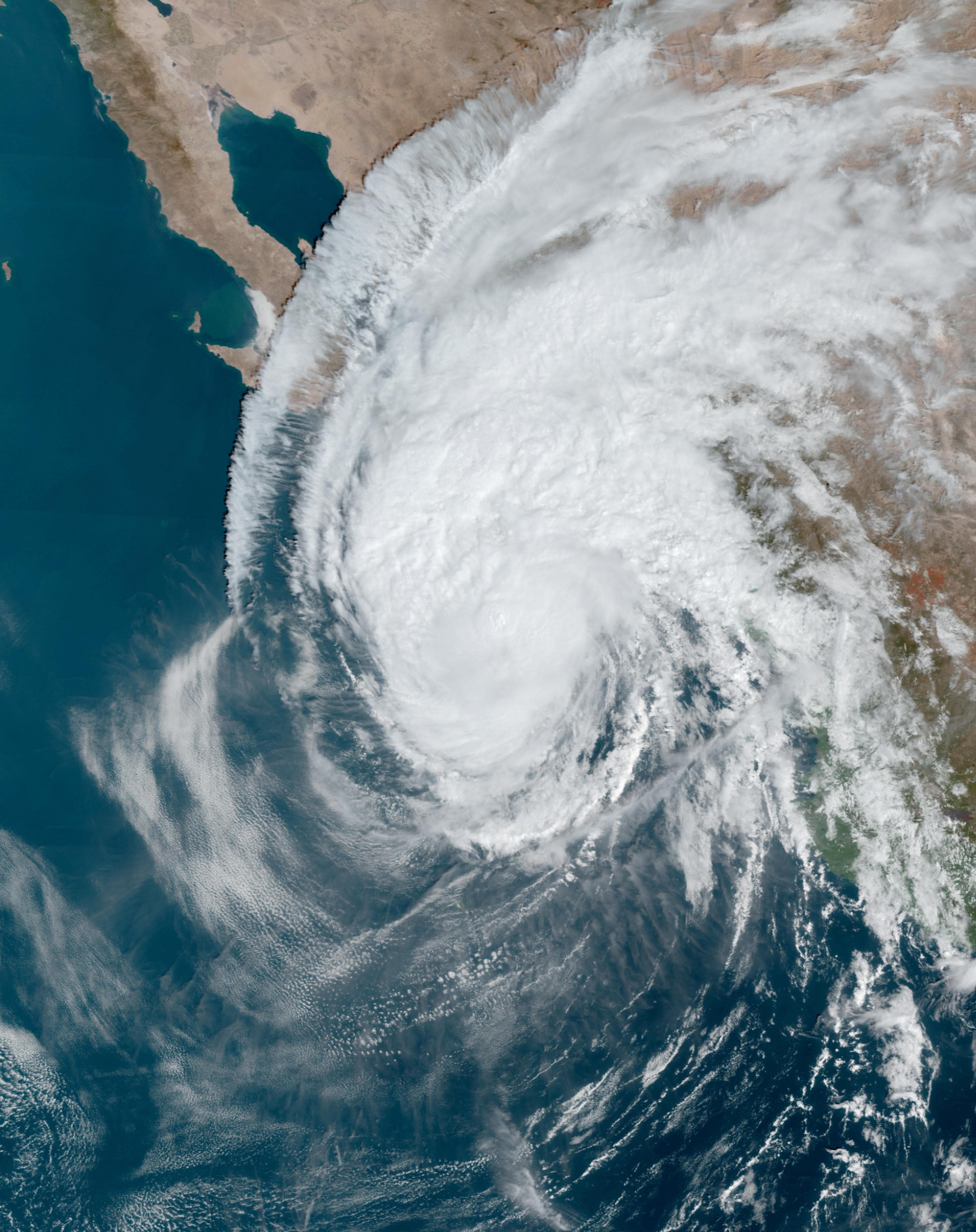
Credit: NOAA GOES-18 · Public domain
Source ↗Hurricane Hilary
A rare north-moving system that brought major rain and flooding to Baja and the U.S. Southwest.
Cat 4 peak / tropical storm landfall near San Fernando, Baja CaliforniaAug 19-20, 2023
Synopsis
- Peak intensity
- Category 4
- Baja impact
- Aug 19-20, 2023
- Landfall or closest pass
- Tropical storm landfall near San Fernando, Baja California
- Primary hazards
- Heavy rain, flash flooding, mudslides, road damage, surf, power outages
Hilary rapidly intensified to Category 4 over the Eastern Pacific before weakening as it moved north toward the Baja California península. It made landfall near San Fernando, Baja California, as a tropical storm on Aug 20, 2023. Although Hilary weakened before landfall, it brought historic rainfall and flooding impacts to Baja California Sur, Baja California, and the southwestern United States.
Local impacts
- Heavy rain and flash flooding affected large parts of the península.
- Significant flooding was reported in Loreto, Mulegé, and Comondú.
- Flooding in Santa Rosalía breached a protection wall and caused a fatal vehicle-related flood incident.
- Storm surge and large waves damaged homes and grounded fishing boats in coastal communities including Punta Abreojos, La Bocana, and Bahía Asunción.
- Several portions of Federal Highway 1 were damaged.
- Strong winds downed trees and electric poles across Baja California, Baja California Sur, and Sonora.
Lessons learned
Hilary was a reminder that a weakening storm can still be dangerous if it carries enough moisture. In Baja, rain and runoff can become the main threat, especially in arroyos, mountain drainages, low-water crossings, and coastal communities exposed to surge and surf.
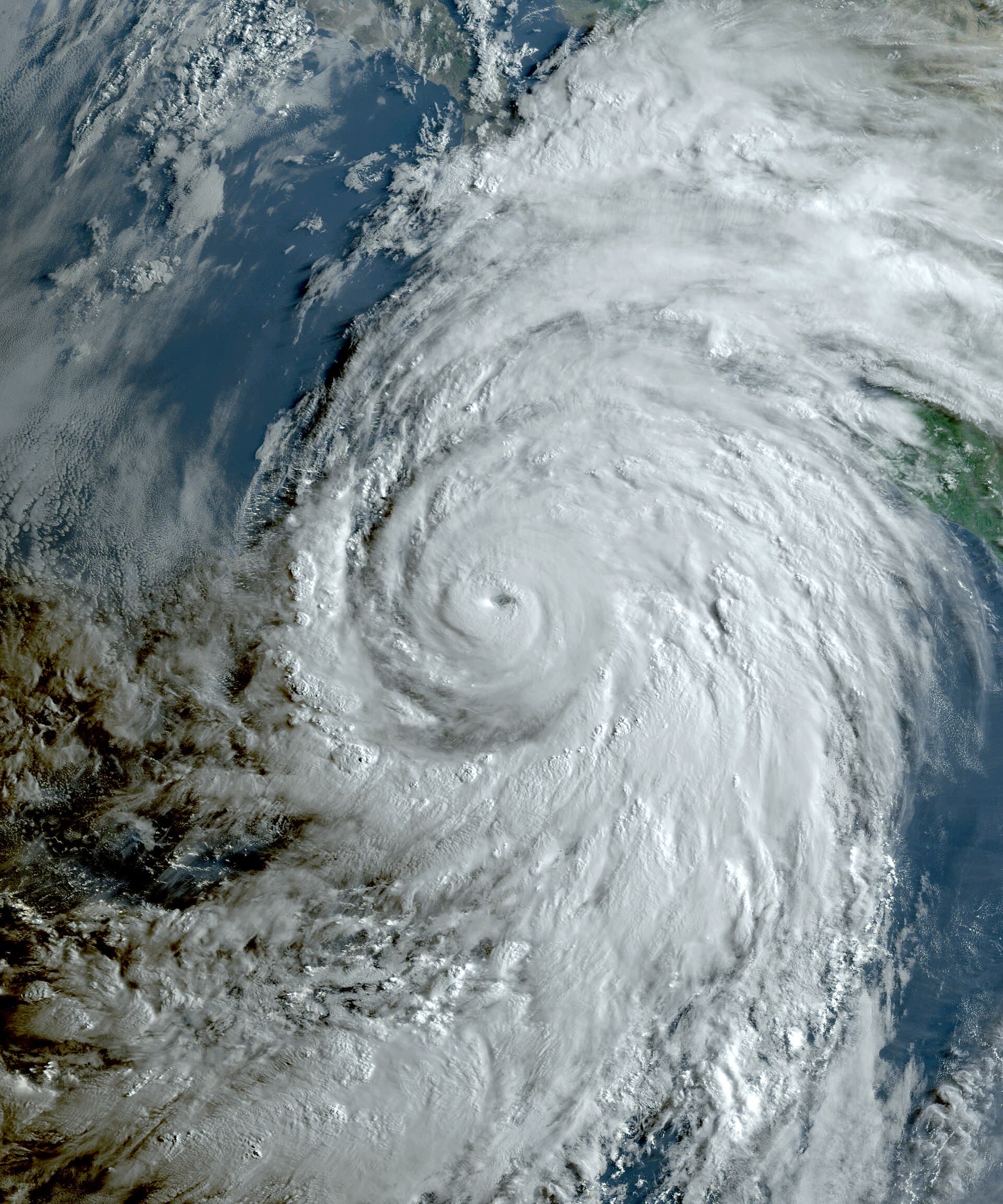
Credit: NOAA GOES-16 · Public domain
Source ↗Hurricane Lorena
A compact hurricane that hugged the southeastern Baja coast and affected La Ventana, La Paz, Los Cabos, and East Cape areas.
Cat 1 landfall near La Ventana, Baja California SurSept 20-21, 2019
Synopsis
- Peak intensity
- Category 1
- Baja impact
- Sept 20-21, 2019
- Landfall or closest pass
- Category 1 landfall near La Ventana, Baja California Sur
- Primary hazards
- Wind, heavy rain, surf, coastal flooding, localized damage
Lorena first affected the mainland coast of México, then moved back over warm water and strengthened again near southern Baja California Sur. It tracked close to the southeastern coast of the península and made landfall near La Ventana on Sept 21, 2019, as a Category 1 hurricane. Lorena was a relatively small storm, but its close track made it important for La Ventana, La Paz, Los Cabos, and East Cape communities.
Local impacts
- Hurricane conditions occurred near La Ventana.
- A weather station in La Ventana reported strong sustained winds and higher gusts as the core moved nearby.
- Significant damage was reported in La Ventana.
- Dangerous surf affected the Los Cabos area.
- Coastal roads and low-lying areas experienced flooding in places.
Lessons learned
Lorena showed that small storms can still create serious local problems if the core passes close to populated areas. For southeastern Baja California Sur, track shifts near the Gulf of California can matter as much as category. La Ventana, Los Barriles, East Cape, La Paz, and Los Cabos all need to watch close coastal tracks carefully.
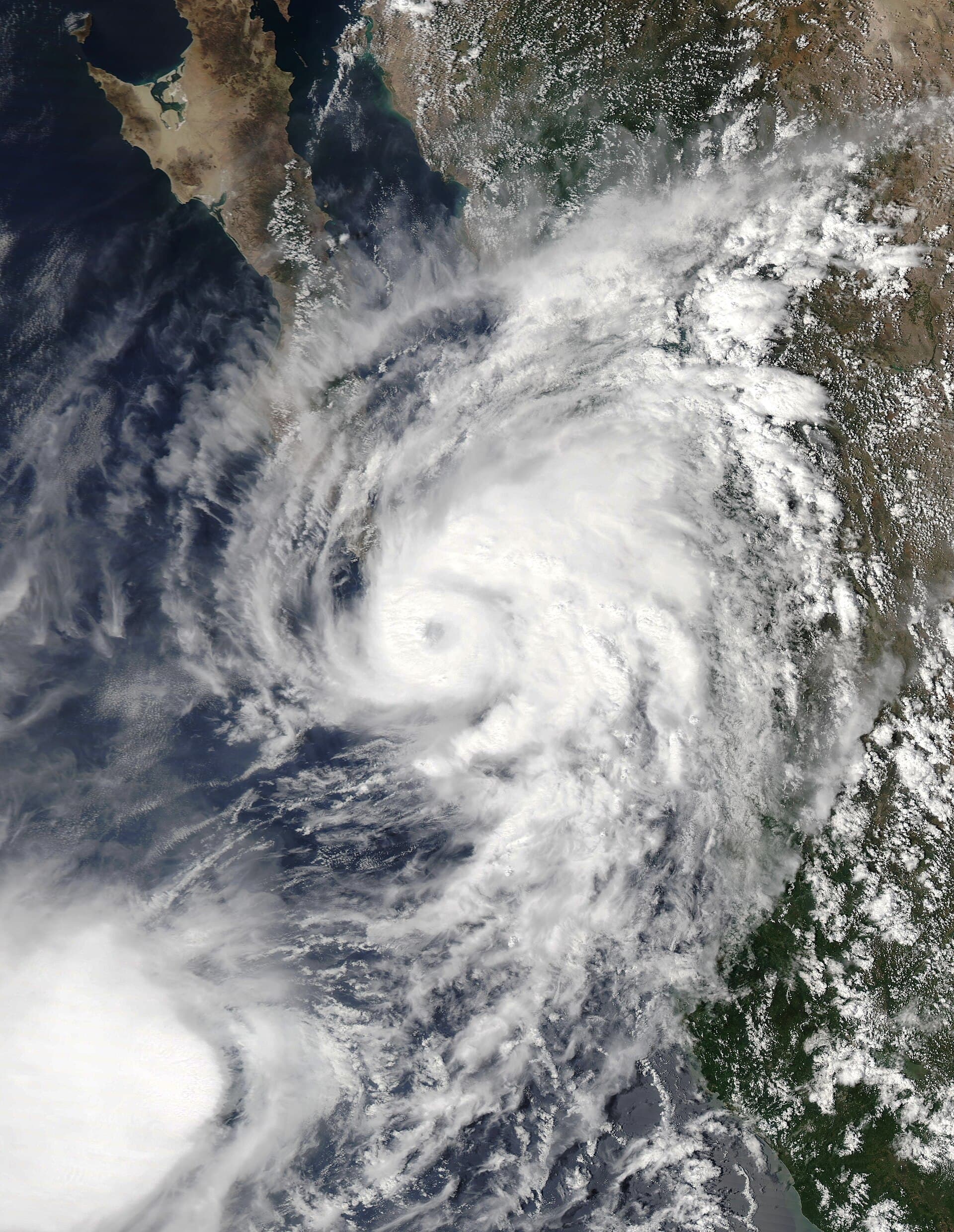
Credit: NASA · Public domain
Source ↗Tropical Storm Lidia
A major rain and flood event for Baja California Sur, especially southern BCS and Los Cabos.
Tropical storm landfalls near Punta Marquez and Punta AbreojosAug 31-Sept 2, 2017
Synopsis
- Peak intensity
- Tropical storm
- Baja impact
- Aug 31-Sept 2, 2017
- Landfall or closest pass
- Tropical storm landfalls near Punta Marquez and Punta Abreojos
- Primary hazards
- Torrential rain, flooding, power outages, road damage, sheltering
Lidia formed near the southern Baja California península and became a large tropical storm. It passed close to Cabo San Lucas, moved along the west coast of the península, made landfall near Punta Marquez on Sept 1, then crossed the coast again near Punta Abreojos on Sept 2. Lidia was not a hurricane, but it produced a major rainfall and flooding event for Baja California Sur.
Local impacts
- Torrential rain fell across southern Baja California Sur.
- Sierra La Laguna recorded the highest reported rainfall total from the storm.
- Flooding damaged homes and roads.
- Power outages affected parts of Baja California Sur.
- Thousands of people were taken to shelters.
- Downed power lines created additional danger after the storm.
Lessons learned
Lidia is one of the clearest examples of why storm category does not tell the whole story. A tropical storm can be extremely dangerous when it is large, wet, slow enough to produce heavy rain, and positioned near Baja's mountains and arroyos. Flood risk should never be judged by wind category alone.
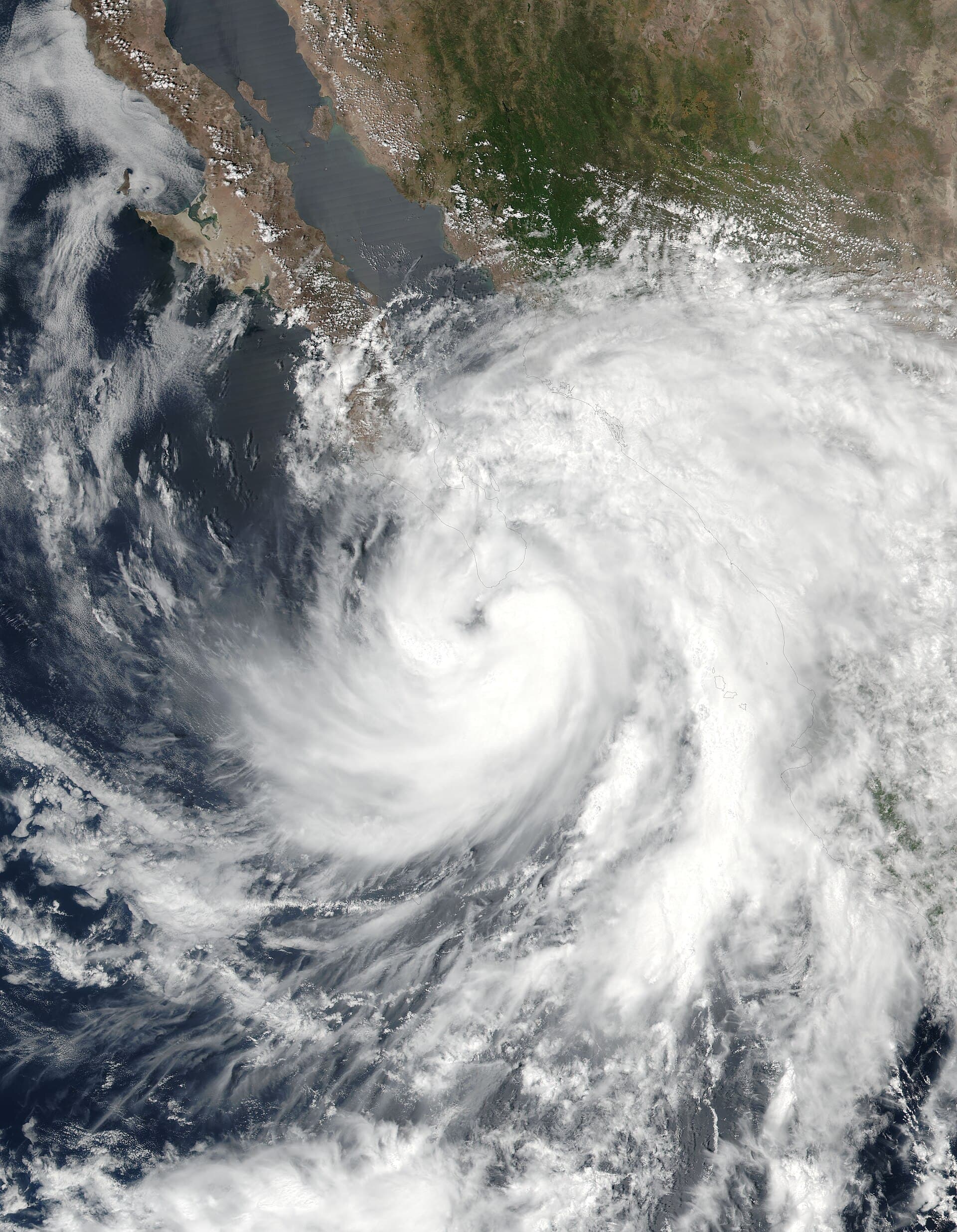
Credit: NASA Suomi NPP · Public domain
Source ↗Hurricane Newton
A fast-moving hurricane that brought eyewall conditions to the southern cape before crossing the península.
Cat 1 hurricane near Cabo San Lucas / landfall near El CunanoSept 6, 2016
Synopsis
- Peak intensity
- Category 1
- Baja impact
- Sept 6, 2016
- Landfall or closest pass
- Struck Cabo San Lucas, then made landfall farther north on the west coast of Baja California Sur
- Primary hazards
- Wind, heavy rain, flooding, landslides, road damage, power outages
Newton became a Category 1 hurricane before reaching southern Baja California Sur. The hurricane struck Cabo San Lucas, then made landfall farther north along the west coast of Baja California Sur on Sept 6, 2016. After crossing the península, Newton moved into the Gulf of California, weakened, and later made another landfall in Sonora.
Local impacts
- Hurricane conditions affected the southern cape.
- Cabo San Lucas reported wind damage, including broken windows and power issues.
- Heavy rain caused much of the serious damage farther north, especially in Mulegé.
- Santa Rosalía experienced rockslides and landslides that damaged homes and vehicles.
- Heroica Mulegé and San Ignacio had significant damage and were cut off by debris on the Transpenínsular Highway.
- Newton caused major damage across Baja California Sur, with state damage estimates reported in the hundreds of millions of pesos.
Lessons learned
Newton showed that the first point of impact is not always where the worst damage occurs. Los Cabos saw wind impacts, but Mulegé, Santa Rosalía, San Ignacio, and Highway 1 were heavily affected by rain, debris, landslides, and road disruption. Storm planning needs to consider the full track, not just the first landfall.
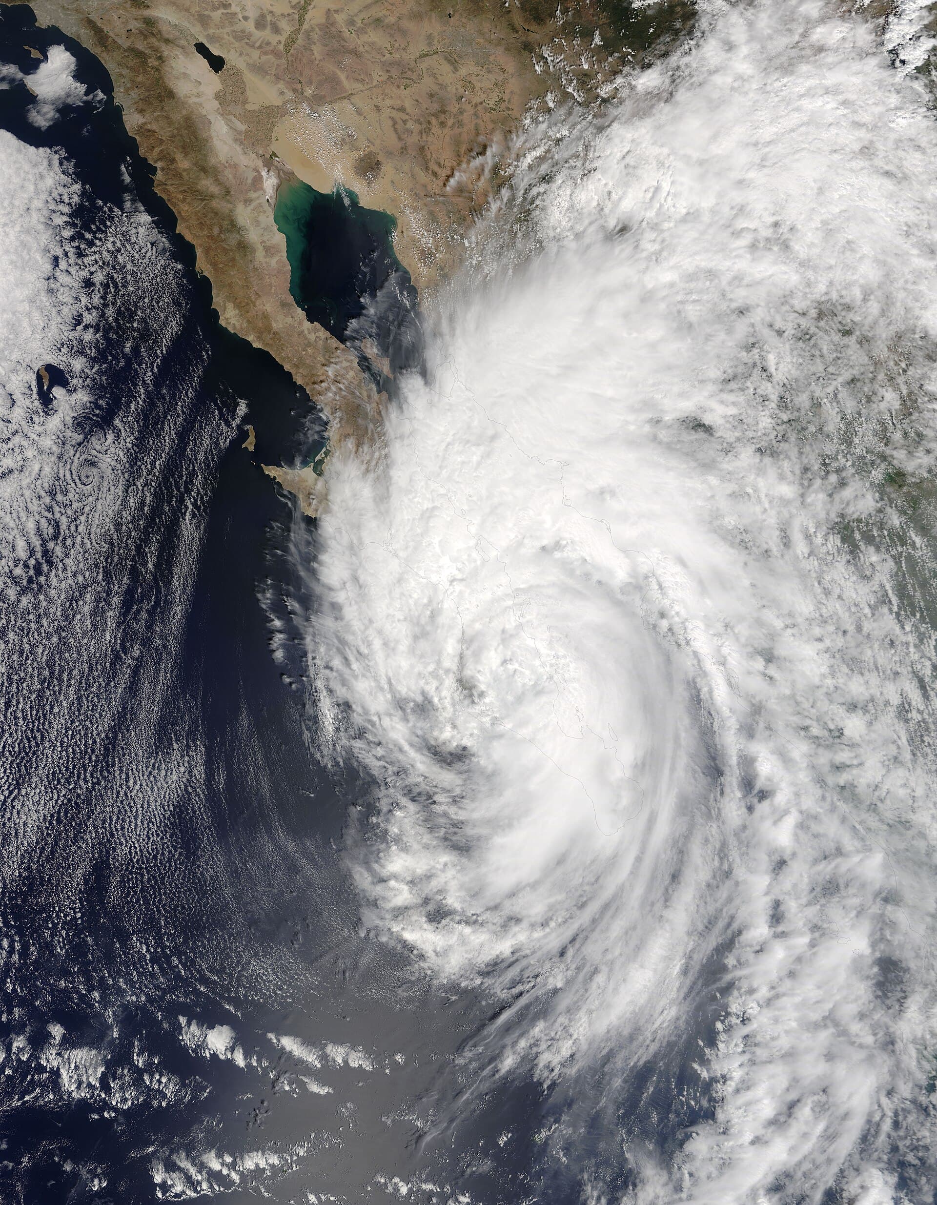
Credit: NASA Terra MODIS · Public domain
Source ↗Hurricane Odile
One of the most damaging storms in modern Los Cabos and Baja California Sur history.
Cat 3 landfall just east of Cabo San LucasSept 14-15, 2014
Synopsis
- Peak intensity
- Category 4
- Baja impact
- Sept 14-15, 2014
- Landfall or closest pass
- Category 3 landfall just east of Cabo San Lucas
- Primary hazards
- Destructive wind, widespread power outages, water outages, structural damage, flooding, road and bridge damage
Odile made landfall just east of Cabo San Lucas at 0445 UTC on Sept 15, 2014, which was late Sept 14 local time, as a large Category 3 hurricane. It was the first major hurricane to strike the region in 25 years and became one of the most destructive storms in modern Baja California Sur history.
Local impacts
- Severe wind damage occurred across Cabo San Lucas and San José del Cabo.
- Hotels, homes, businesses, and the Cabo San Lucas airport suffered major damage.
- More than 90 percent of Baja California Sur's population lost electricity.
- Water and communications were disrupted in parts of Los Cabos.
- Thousands of tourists were stranded after flights were cancelled.
- Damage extended north to Todos Santos, Pescadero, La Paz, Loreto, Comondú, Mulegé, and other communities.
- Roads and bridges were damaged or washed out, complicating relief efforts.
Lessons learned
Odile remains the modern benchmark storm for Los Cabos and southern Baja California Sur. It showed the need to prepare not only for landfall, but for days or weeks of outages, limited communications, airport closure, supply shortages, road damage, and recovery delays. Odile is the storm that explains why serious preparation matters every season.
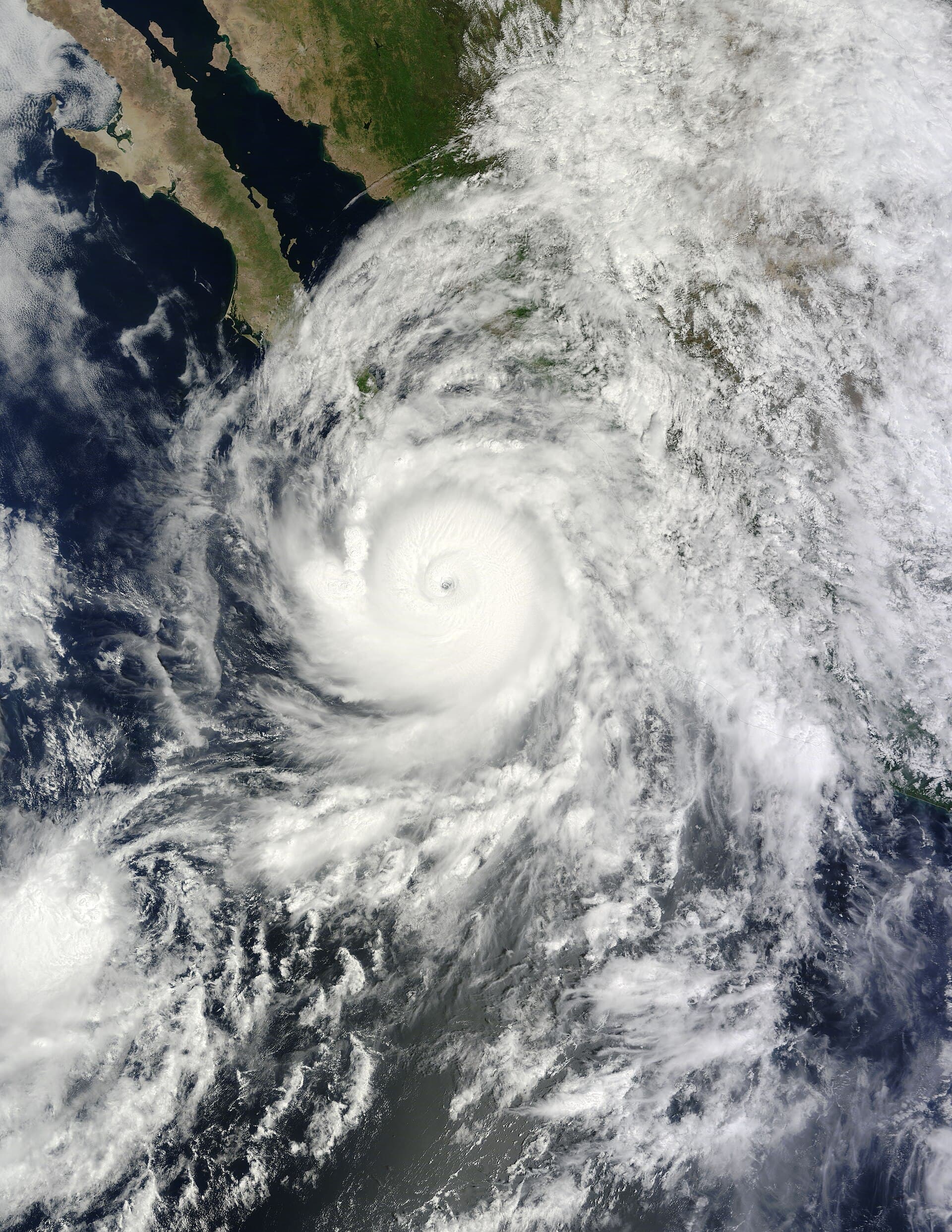
Credit: NASA Terra MODIS · Public domain
Source ↗Hurricane Jimena
A powerful Pacific-side hurricane that struck central Baja California Sur and later affected Gulf-side communities.
Cat 4 peak / Cat 2 landfalls near Isla Santa Margarita and Puerto San CarlosSept 2-4, 2009
Synopsis
- Peak intensity
- Category 4
- Baja impact
- Sept 2-4, 2009
- Landfall or closest pass
- Category 2 landfall on the Pacific side of Baja California Sur, with the eye passing over Puerto San Carlos
- Primary hazards
- Wind, freshwater flooding, heavy rain, infrastructure damage, road disruption
Jimena became a powerful Category 4 hurricane off the Pacific coast of México before weakening and striking central Baja California Sur. It affected the Pacific side of the península as a Category 2 hurricane, with the eye passing over Puerto San Carlos, then continued north and later affected Gulf-side communities.
Local impacts
- Hurricane conditions likely affected parts of the data-sparse Pacific coast south of San Juanico.
- Ciudad Constitucion recorded strong sustained winds and higher gusts.
- Puerto San Carlos experienced the passage of Jimena's eye.
- Heavy rain affected central and southern Baja California Sur.
- Ciudad Constitucion, Mulegé, Loreto, and smaller communities near the track were reported as hard hit.
- One death was attributed to freshwater flooding in Mulegé.
- Damage to buildings was widespread, with reports suggesting tens of thousands of damaged structures.
Lessons learned
Jimena showed the exposure of the Pacific side of Baja California Sur, especially central BCS communities that may not get the same attention as Los Cabos. It also reinforced the need to prepare for multi-region impacts as storms cross the península and affect both Pacific and Gulf-side communities.
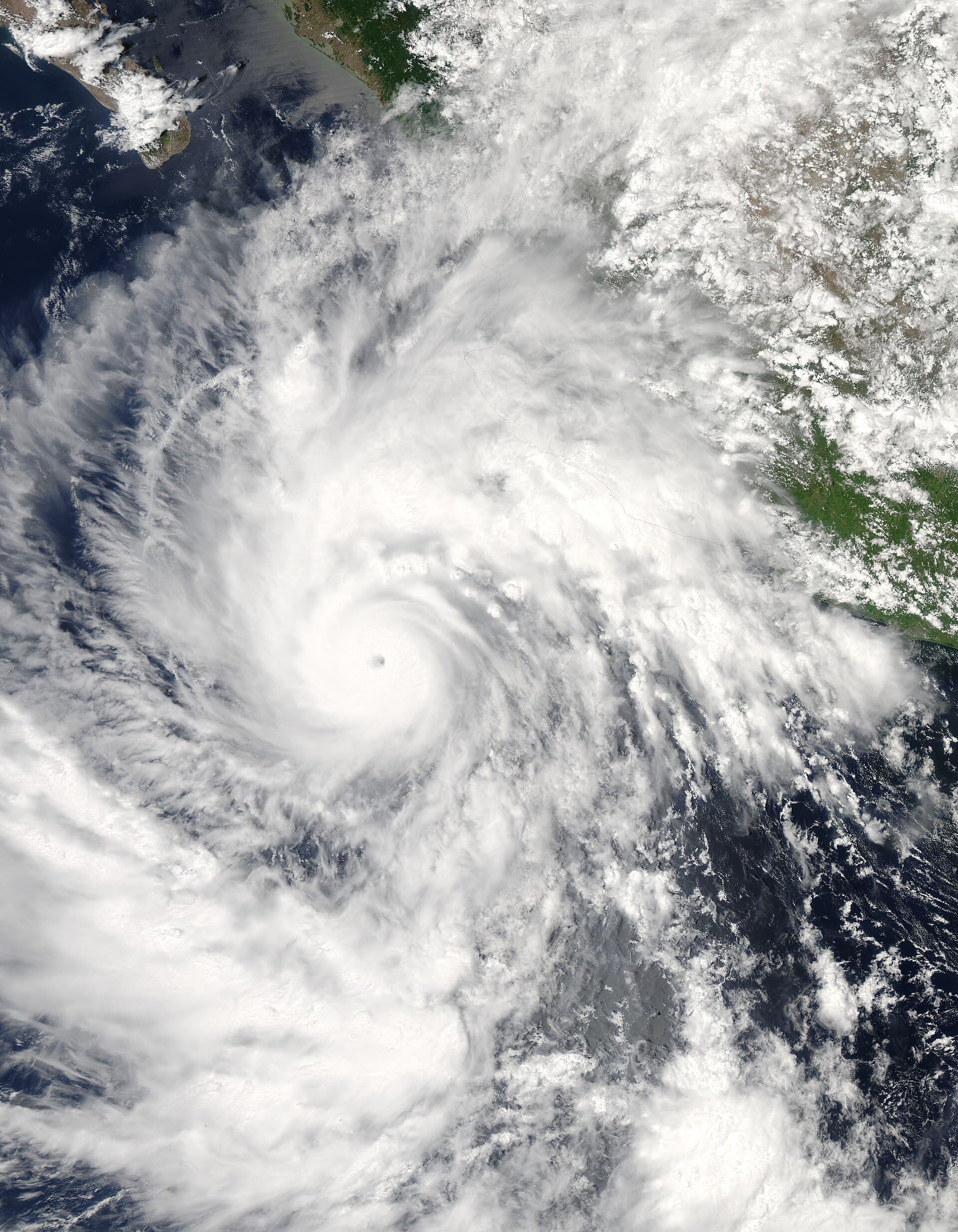
Credit: NASA · Public domain
Source ↗Hurricane John
A strong hurricane that hit northeast of Cabo San Lucas and moved near La Paz before weakening up the península.
Cat 4 peak / high-end Cat 2 landfall at Cabo del EsteSept 1-2, 2006
Synopsis
- Peak intensity
- Category 4
- Baja impact
- Sept 1-2, 2006
- Landfall or closest pass
- Category 2 landfall at Cabo del Este, about 40 nautical miles northeast of Cabo San Lucas
- Primary hazards
- Hurricane winds, heavy rain, flooding, rural isolation, home damage
John reached Category 4 strength over the Eastern Pacific before weakening and turning toward Baja California Sur. It made landfall at Cabo del Este around 0200 UTC on Sept 2, 2006, with maximum winds estimated near 95 knots, which is high-end Category 2. The storm then moved near or just inland along the eastern side of the península and passed near La Paz before weakening.
Local impacts
- Hurricane conditions affected the Cabo del Este area.
- La Paz reported strong winds as the center passed nearby.
- Rainfall was recorded in multiple Baja California Sur communities, including San José del Cabo, La Paz, Santiago, San José de los Planes, and Santa Rosalía.
- Homes were damaged or destroyed in parts of southern Baja California Sur.
- Flooding and road impacts affected rural communities.
- Five deaths were attributed to John.
Lessons learned
John is a strong reminder that a Baja landfall does not have to occur directly over Cabo San Lucas to matter. East Cape, La Paz, Comondú, Mulegé, and smaller rural communities can all face serious risk from a storm tracking up the Gulf side of the península.
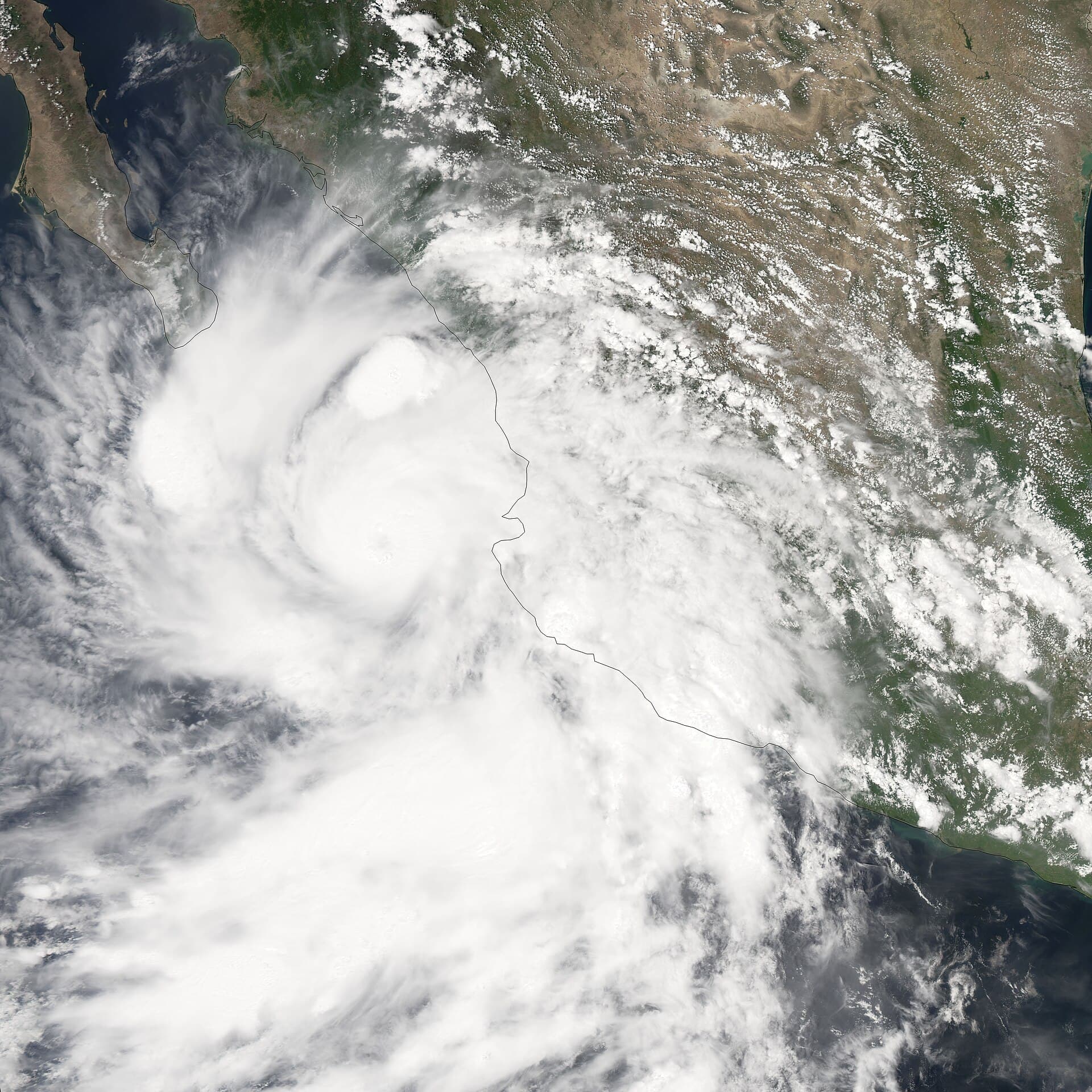
Credit: NASA Aqua MODIS · Public domain
Source ↗Hurricane Marty
A Gulf-side storm that affected Los Cabos, La Paz, Santa Rosalía, and coastal communities along the península.
Cat 2 landfall near San José del CaboSept 22, 2003
Synopsis
- Peak intensity
- Category 2
- Baja impact
- Sept 22, 2003
- Landfall or closest pass
- Category 2 landfall near San José del Cabo, just east of Cabo San Lucas
- Primary hazards
- Wind, heavy rain, coastal damage, marine damage, flooding, short-warning landfall
Marty strengthened into a Category 2 hurricane as it approached southern Baja California Sur. It made landfall near San José del Cabo at 0930 UTC on Sept 22, 2003, with estimated maximum winds of 85 knots. The center then entered the Gulf of California near La Paz and moved along the eastern side of the península.
Local impacts
- Category 2 hurricane conditions affected the Los Cabos area.
- Cabo San Lucas reported very strong wind gusts.
- La Paz, Todos Santos, Loreto, and Santa Rosalía reported significant rainfall.
- Marine impacts affected La Paz Harbor and other Gulf-side coastal areas.
- Marty caused damaging wind and flood impacts across southern Baja California Sur.
- The hurricane warning lead time was relatively short, with official forecasts shifting late toward the actual landfall area.
Lessons learned
Marty showed how quickly a storm can become a Gulf-side Baja event. It also showed that forecast tracks can shift significantly in the final day. Residents should not wait for perfect certainty before preparing, especially when a hurricane is close and the southern península is within the warning area.
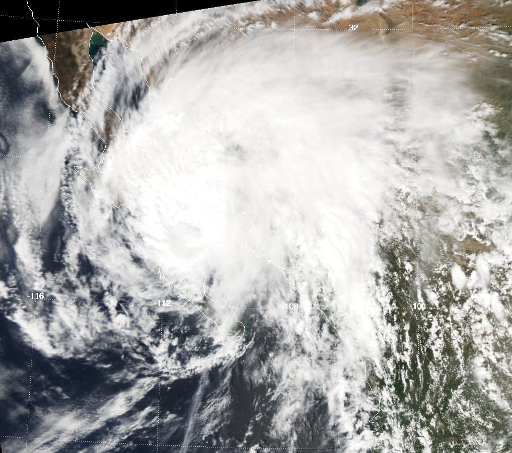
Credit: NASA Aqua · Public domain
Source ↗Hurricane Juliette
A slow-moving storm that battered southern Baja with wind, rain, surf, and prolonged disruption.
Cat 4 peak / hurricane conditions near southern BCS, later tropical storm landfall near San CarlosSept 27-30, 2001
Synopsis
- Peak intensity
- Category 4
- Baja impact
- Sept 27-30, 2001
- Landfall or closest pass
- Passed just west of Cabo San Lucas as a hurricane, later moved inland near San Carlos as a weakening tropical storm
- Primary hazards
- Strong wind, prolonged rain, surf, flooding, isolation, road disruption
Juliette became a powerful Category 4 hurricane over the Eastern Pacific, then weakened while turning north toward Baja California Sur. The center passed just west of Cabo San Lucas on Sept 28, 2001, with hurricane-force winds still affecting the region. Juliette later moved inland near San Carlos on the west coast of Baja California as a weakening tropical storm.
Local impacts
- Southern Baja California Sur experienced strong winds, heavy rain, and large waves.
- Cabo San Lucas recorded hurricane-force sustained winds and stronger gusts.
- An unconfirmed report described more than a foot of rain at Cabo San Lucas.
- Santiago recorded significant rainfall.
- Cabo San Lucas was isolated from the outside world for several days.
- High seas caused at least one death near the Baja California coast.
- Flooding also affected Sonora.
Lessons learned
Juliette showed the danger of slow-moving storms. Even as a storm weakens, prolonged rain and surf can create serious disruption. In Baja, slow movement near the península can mean extended flooding, blocked roads, isolated communities, and repeated rounds of coastal impacts.
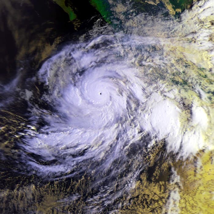
Credit: NOAA · Public domain
Source ↗Hurricane Liza
One of Baja California Sur's deadliest storm disasters, remembered for catastrophic flooding in La Paz.
Cat 4 peak / historic La Paz flood disasterSept 30-Oct 1, 1976
Synopsis
- Peak intensity
- Category 4
- Baja impact
- Sept 30-Oct 1, 1976
- Landfall or closest pass
- Brushed the eastern tip of Baja California, then moved north through the Gulf of California
- Primary hazards
- Catastrophic flooding, dam failure, loss of life, severe damage in La Paz
Liza is one of the most important storms in Baja California Sur history. The hurricane brushed the eastern tip of Baja California and moved north through the Gulf of California before making landfall north of Los Mochis. Its most devastating impact was in La Paz, where heavy rain contributed to the failure of an earthen dam and catastrophic flooding.
Local impacts
- La Paz sustained severe damage.
- Heavy rain led to the failure of an earthen dam.
- Floodwaters killed hundreds of people.
- The disaster remains one of the deadliest storm-related events in Baja California Sur history.
- Liza left a long-term mark on how the region understands flood risk.
Lessons learned
Liza is the clearest historical warning that flood planning can be more important than the exact hurricane track. A storm does not need to make a classic direct landfall over La Paz to create catastrophic local impacts. Arroyos, dams, drainage systems, low-lying neighborhoods, and fast desert runoff can turn rain into a disaster very quickly.
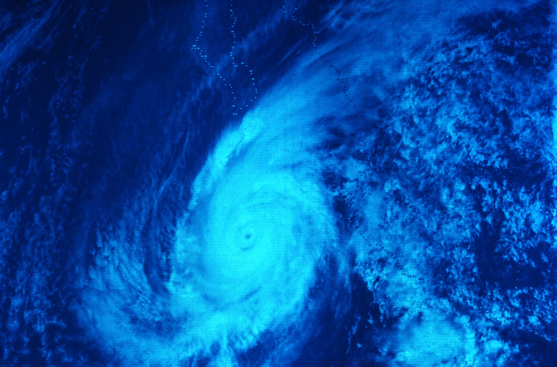
Credit: NOAA · Public domain
Source ↗